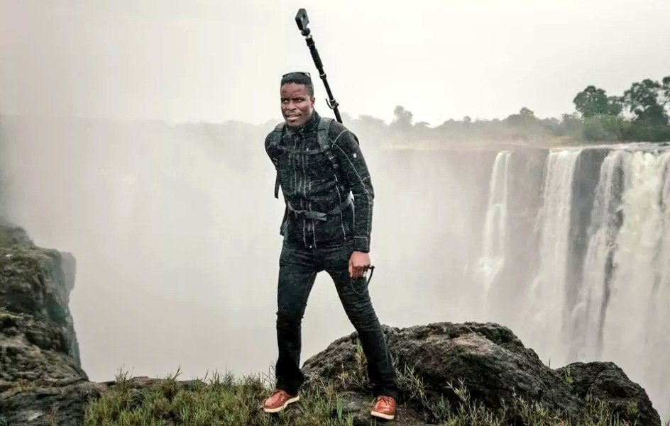
Since 2018, Tawanda Kanhema has been carrying Street View gear across thousands of miles of Africa and Canada to make them more complete and representative on Google Maps.
“If you were to use certain maps as your way of getting a sense of the world, there are certain places that would completely not exist.”
“And so looking at southern Africa particularly, and much of Africa for that matter, I knew that there was not a single story I could write that could help answer some of the questions people have about places other than the US and Western Europe.
So I was looking for a way to collect this imagery and share it with the largest number of people I could reach and help make their world a little bigger.”
To allow people to experience these locations virtually Tawanda has had to endure extreme environments.
“For most of the projects I’ve just picked up the gear and gone on a trek. It can be quite a solitary experience being out there with just a camera especially for driving, driving for us with just this setup.”
One of the locations Tawanda Kanhema has had to visit to map is the Skeleton Coast, in Namibia.
Being in Namibia feels like witnessing the last few months of the glacial drift that occurred here a few million years ago. The sun’s intensity is just relentless.”
He has also been to Northern Ontario in Canada.
“At the ice roads of Northern Ontario, these roads only exist for only around 90 days a year. It was constantly below freezing during the time we were there. It’s reassuring to know that these experiences are things that millions of people will see. These experiences millions of people who cannot otherwise travel can experience in virtual reality.”
Since he began his journey, Tawanda has mapped over 3,000 miles previously unmapped areas of Street View.
“It’s really about the people, connecting with people in different communities connecting people across the country. I still get the emails every single day from people who are expressing gratitude. Things like, ‘thank you for allowing me to show my kids the hospital in which I was born.’
“There are a lot of people who have left Zimbabwe over the years and the only way they can really visually transit those places again is by going through these images.”
In his journey to continue mapping locations, Tawanda wants communities to also be able to get access to the gear to tell their own stories over time.
“The one thing that I’ve learnt is that it’s really important for us to continue to look for opportunities to amplify the voices of communities and beyond that to look for opportunities to put some of these tools in the hands of people in these communities to actually tell their own story.”

